20 sprites from Mont Aigoual!
Last night our team from Toulouse went with the camera to Mont Aigoual. We are happy to report the observation of 20 sprites: 14 columniform ones and 6 carrots! A couple of storm systems were active over northern France, at about 500 km distance from our camera.
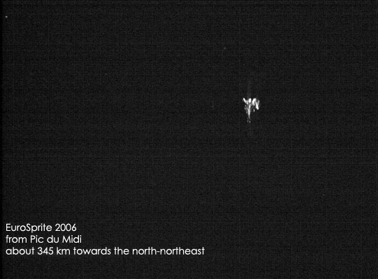
At 2111 UTC the first sprite was captured in that direction, the last one (nr. 14) happened at 0036 UTC, after which we turned the camera to the closer line of storms to our northwest, that started to form a stratiform precipitation region. A very close carrot sprite at 0113 UTC was the first we observed from that storm, followed by a number of columns and another big carrot at 0136 UTC. The last sprite of the night was caught at 0202 UTC. A pity is also that Pic du Midi as well as Joan Montanya had technical problems. But fortunately the Pic camera was stuck to the north and was able to capture a number of sprites - including the big carrots of 0113 UTC and 0136 UTC, so we have our first simultaneous multi-location observations of the same sprites, allowing triangulation and a 3D view. The column sprite events we recorded from Mont Aigoual during this period may have been too dim to trigger at Pic du Midi. These sprites occurred near Limoges.
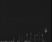
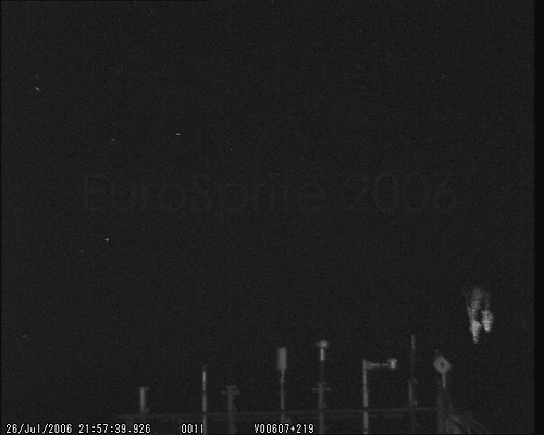
Pic du Midi:

Mont Aigoual:

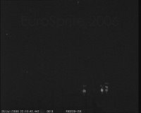
and the second one:
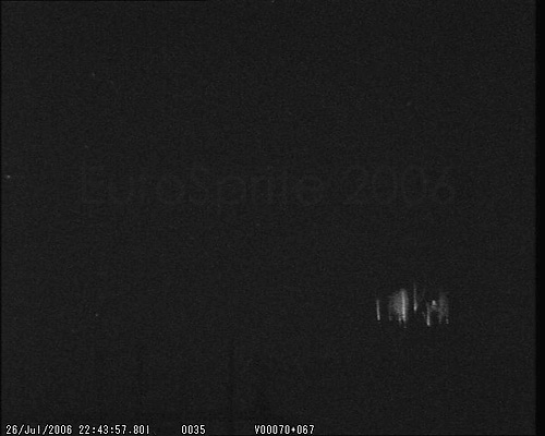
Pic du Midi:

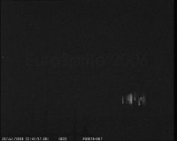
Mont Aigoual:

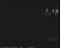
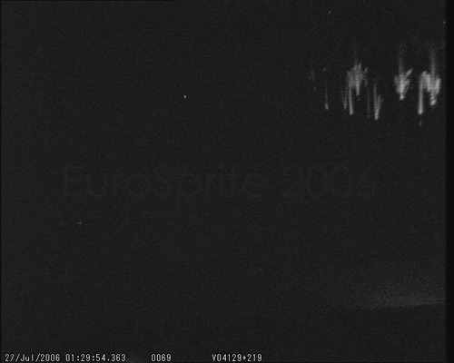
More from Mont Aigoual:

Because we were observing 'live', we tried to see the sprites, but we had no success so far. We could see some lightning flashes that produced sprites, but then failed to see the sprite.
A verification of recorded sprite time and parent lightning time proved that unfortunately our GPS time synchronisation isn't quite reliable.
From Pic du Midi 3 other sprites were recorded after 0200 UTC, that were missed at Mont Aigoual. They may have occurred out of camera view, or the camera ran out of battery power. But this night can be considered successful!

At 2111 UTC the first sprite was captured in that direction, the last one (nr. 14) happened at 0036 UTC, after which we turned the camera to the closer line of storms to our northwest, that started to form a stratiform precipitation region. A very close carrot sprite at 0113 UTC was the first we observed from that storm, followed by a number of columns and another big carrot at 0136 UTC. The last sprite of the night was caught at 0202 UTC. A pity is also that Pic du Midi as well as Joan Montanya had technical problems. But fortunately the Pic camera was stuck to the north and was able to capture a number of sprites - including the big carrots of 0113 UTC and 0136 UTC, so we have our first simultaneous multi-location observations of the same sprites, allowing triangulation and a 3D view. The column sprite events we recorded from Mont Aigoual during this period may have been too dim to trigger at Pic du Midi. These sprites occurred near Limoges.
Pic du Midi:
Mont Aigoual:

and the second one:
Pic du Midi:

Mont Aigoual:

More from Mont Aigoual:

Because we were observing 'live', we tried to see the sprites, but we had no success so far. We could see some lightning flashes that produced sprites, but then failed to see the sprite.
A verification of recorded sprite time and parent lightning time proved that unfortunately our GPS time synchronisation isn't quite reliable.
From Pic du Midi 3 other sprites were recorded after 0200 UTC, that were missed at Mont Aigoual. They may have occurred out of camera view, or the camera ran out of battery power. But this night can be considered successful!
posted by Oscar van der Velde at 13:30
0 comments
![]()
![]()
