Friday, September 09, 2005

9 September 20:35UT: Interesting sprite from Pic du Midi


This evening was clear at Pic du Midi with thunderstorms coming in from the Biscay and closing up on the Pyrenees. Puy de Dome was in clouds as this sprite was caught.
Detail from the wide-field camera.

8/9 September: Sprites from Puy de Dome

Note that these images show the two interlaced video frames from each period on top of each other.


Promising thunderstorms all night, but Pic du Midi was overcast. In the beginning Puy de Dome triggered on local lightning which did not show up in Meteorage. These sprites were captured by Peter at around 01:08 UT.


And another one at 03:02


03:45: Illuminated cloud or halo?

Thursday, September 08, 2005

Dawn and dusk


This plot shows the time (UT) of dawn and dusk for Pic du Midi, assuming a solar dip of 10 degrees (roughly "civil twilight", astronomical twilight is calculated for 18 degrees).

Wednesday, September 07, 2005

Sprites observed from Switzerland 6-7 September


Last night when the EuroSprite team caught only one sprite due to cloudiness over the cameras, amateur astronomist/photographer Mark Vornhusen caught many sprites from Gais, Switzerland that appeared near the French-Italian border, some of which he posted to a German weather forum: http://www.wetter-zentrale.com/cgi-bin/webbbs/wzconfig.pl?read=741655
Among the images he obtained is a remarkable colour image, showing sprites as weak red patches. He obtained this with his digital SLR camera the Nikon D70 set at ISO 1600 and using a bright 50mm f/1.2 lens - to my knowledge he is the first person to succeed in that! Note that the same sprite was captured by his low-light video setup, showing in fact a very bright sprite event. Congratulations to Mark!

6-7 September: One sprite caught


At the beginning of the night both stations were mostly cloudy but the view from Pic du Midi cleared
up. This sprite was caught at 02:16 UT looking somewhere around 43.5 degrees north and 6 degrees east. Puy de Dome seems to have had clouds all night,

Tuesday, September 06, 2005

Night 5/6 September: Thunderstorm but problems

The night of 5-6 September saw a stable front over France and there was finally some persistent thunderstorm activity. Unfortunately both stations were overcast for the whole night.

Monday, September 05, 2005

Thunderstorm Outlook: Mon 5 - Wed 7 September

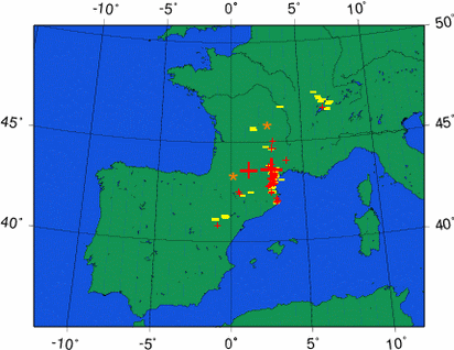
A persistent thunderstorm situation is taking place over southern France today and tomorrow. Slow-moving systems with strong lightning activity have developed since the afternoon and due to cyclogenesis (formation of an own low pressure area), the storms will stick and return over the area. Fuel to sustain storms is provided by the cold upper airmass that is advected over an inflow of Mediterranean moisture rising over the southern slopes of the Massif-Central.

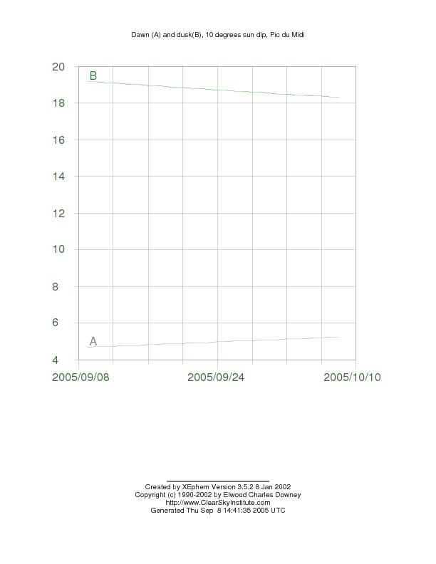
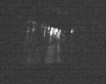
Currently (Mon 22:25), the system is very well positioned for observation by our cameras, but both are covered in cloudiness. The waiting is for the cloud deck to lower or dissolve near Pic du Midi, not impossible. Let us hope we will get a clear sky sometime these nights, we haven't been very fortunate this summer with the clouds when good storm systems were nearby.